You thought much of the planet had shifted to metric!
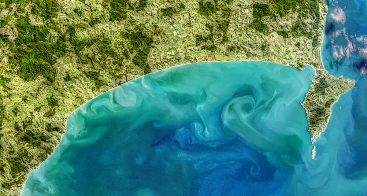
We’re often encouraged to change our perspective, and “look at the view from 30,000 feet” (about the cruising altitude of a commercial jet). The phrase implies being able to step back and see the big picture, and there’s no arguing that the view from an aircraft gives a new perspective to what we see on the ground.
But what about 1,476,378 feet?
That number is about 450km or the altitude of low earth orbit (LEO) satellites. Geostationary satellites are higher again, up to around 600km.
Does that increase in altitude and the potential use of remote sensing technologies from satellites enable us to understand a different story about our farming systems?
For governments and NGOs, food supply chains, and financial organisations, a remote sensing assessment of farm systems can be attractive. Engagement with hundreds or thousands of individual land managers can be replaced by a contract with a satellite imagery provider. Data capture effort of farmers or auditors is replaced by the camera lens and/or synthetic aperture radar (SAR). Assessment is replaced by evidence.
At first glance, this sounds attractive: so attractive that a plethora of businesses will sell you a wide range of agricultural information based on analysis of remote sensing data at various scales. Some of these might be uniquely valuable, for farmers and growers as well as value chains.
However, I am personally less confident that remote sensing technologies will completely replace the use of farm-scale data for assessing and improving carbon emissions intensity, farm performance, and nature positive activities. I think there are real benefits for assessing deforestation and afforestation, but farm activities are harder.
Remote sensing can be variable.
The science of remote sensing relies on a significant body of knowledge about how data should be selected, prepared, and used. Many remote sensing providers carefully follow these best practices, but it can be tempting for those of us who are newer to remote sensing (perhaps with an agricultural or nature background) to get excited about the potential in data sets and miss the details that need to be considered.
Examples include sourcing data from imaging devices with different specifications or seeking high spatial resolution data (smaller pixel size) and missing the importance of spectral resolution (the number of visible and infra-red bands supported).
In recent work with the very experienced Ian Yule, I learned about tasking vs. archive data, satellite azimuth, sun angle and time of day or season, and revisit times (here is some light reading from a Canadian study). There is also a significant difference between the potential of a research study and reproducing it at scale.
This means that the resulting analysis and predictions from this sort of data need to be considered with caution. Artificial Intelligence (AI) or machine learning might be great at predicting the crop in a field, but significantly less reliable at predicting non-canopy biodiversity in a forested area. Ground truthing will be essential to address errors and improve future predictions.
There are things we just can’t see.
Can you see individual sheep from space?
High-resolution military satellites already have that resolution. Whether the revisit time of commercial and economical remote sensing systems will allow adequate tracing and accounting for individual livestock is another matter.
Remote sensing certainly cannot yet account for most farming practices, agrichemical and fertiliser use, or the provenance of livestock feeds. We need other data sources for all of these.
At present, an agricultural carbon emissions system that is solely based on remote sensing data will likely be categorising land areas, applying assumptions about land use, and using averaged or indicative emissions factors.
Where are people in the equation?
Remote sensing is attractive because it removes the “people” element from the assessment process. Machine learning and AI can combine the variety of spectral data and make a categorisation without farmers, land managers, and auditors or other advisors being involved.
This strength is also a weakness. Farmers, land managers, communities and advisors are not involved. We may entirely miss the nuances of farm practice that make all the difference in emissions or natural capital, and instead return to “the average.”
Worse, farmers and growers miss the valuable feedback and analysis that will help them make decisions about their future farming practices. If the advantage of remote sensing is the ability to get timely data about things people can’t easily measure, then the counterpoint is the need for people to then review, make decisions, and act.
Bullish about the future.
I’m bullish about the potential for satellite data, whether from 1,476,378 feet or the metric 450-600km! Provided we pay careful attention to appropriate and consistent use of the data, the insights from these systems could add real value to farmers and growers. However, disconnecting remote sensing from land managers and their advisors – or from farm-scale data – is a recipe for assumptions, inaccuracy, and (at best) averaging, so if you are contemplating using remote sensing, think about how on-farm data and farmer review could improve your outcomes.


